Accepted article — Continental divide location and mobility
My first peer-reviewed manuscript was recently accepted for publication in Basin Research! The manuscript explores the controls on continental divide location and mobility. In particular we explore the impacts of exogenic (allogenic) forcings that adjust topographic gradients in the landscape and ascertain what the relevant length scales for driving continental divide migration may be.
See the full publication here: http://onlinelibrary.wiley.com/doi/10.1111/bre.12256/full
A preview (submission version) can be found here, in accordance with the terms of the license agreement.

Exogenic forcing and autogenic processes on continental divide location and mobility
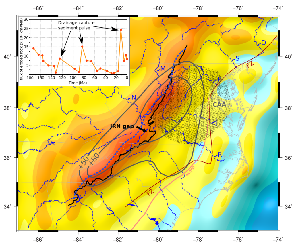
The position and mobility of drainage divides is an expression of exogenic landscape forcing and autogenic channel network processes integrated across a range of scales. At the large scale, represented by major rivers and continental drainage divides, the organization of drainage patterns and divide migration reflects the long-wavelength gradients of the topography, which are exogenically influenced by tectonics, isostasy, and/or dynamic topography. This analysis utilizes long-wavelength topography synthesized by a low-pass filter, which provides a novel framework for predicting the direction of divide movement as well as an estimate of the ultimate divide location, that is complementary to recent studies that have focused on the χ channel metric. The Gibraltar Arc active plate boundary and Appalachian stable plate interior, two tectonically diverse settings with ongoing drainage system reorganization, are chosen to explore the length scales of exogenic forcings that influence continental drainage divide location and migration. The major watersheds draining both the active and decay-phase orogens studied here are organized by topographic gradients that are expressed in long-wavelength low-pass filtered topography (λ ≥ 100 km). In contrast, the river network and divide location is insensitive to topographic gradients measured over filtered wavelengths < 100 km that are set by local crustal structures and rock type. The lag time between exogenic forcing and geomorphic response and feedbacks cause divide migration to be unsteady, and occur through pulses of drainage capture and drainage network reorganization that are recorded in sedimentological, geomorphic, or denudation data.
This article is protected by copyright. All rights reserved.
This material is based upon work supported by the National Science Foundation (NSF) Graduate Research Fellowship under Grant No.145068 and NSF EAR-1427177. Any opinion, findings, and conclusions or recommendations expressed in this material are those of the author(s) and do not necessarily reflect the views of the National Science Foundation.
