
Yellow River (Huanghe) 2016 survey plans
I’ll be departing soon for my second field campaign on the Yellow River, China. We traveled there around the same time last year to generate a dataset we could begin to explore and develop research ideas; now, a year later, we will return with a more focused plan to gather the data we need to address our research questions. We will bring with us a suite of sophisticated data collection equipment. Below is a terrible sketch I made to demonstrate most of the data we will collect at each of our stations located on the river.
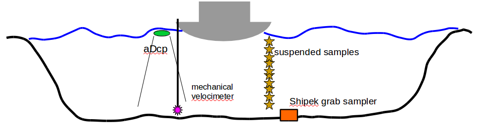
Pretend that the grey thing floating on the water might look like a boat, viewed from the back. We aim to characterize the mechanisms for sediment transport within the Yellow River at various stages of a flood discharge curve. We use a point-integrating sediment sampler to collect numerous suspended sediment and water samples from various depths in the water column (yellow stars). In order to compare the compositions of suspended material to its source (i.e., the bed), we use a Shipek grab sampling device to collect sediment from the bed for our analysis. Deployed off the other side of the boat, we will can characterize the velocity structure of the water column through the use of an aDcp (acoustic velocity profiler) and a mechanical propeller driven velocimeter for near-bed measurements where the aDcp may lack resolution.
This setup represents only a portion of our survey plans, of course we’ll be there for six weeks that will generate a diverse and (hopefully!) comprehensive dataset for our future work.